

Hydra might have no roads to speak of but its network of trails connecting its settlements with its beaches, monasteries, chapels, old pastures and its highest peaks are maintained in excellent condition.
What is Rock Race;
The Rock Race is an 18 km mountain running event which aspires to highlight the beauty of Hydra’s mountain scenery, without exposing the participants to the demanding elements of the Hydra’s Trail Marathon. It guides the runners through old threshing floors, chapels, abandoned windmills and ancient foot bridges, but the best part is, arguably, the coastal portions of the race where you will be running along the coast.
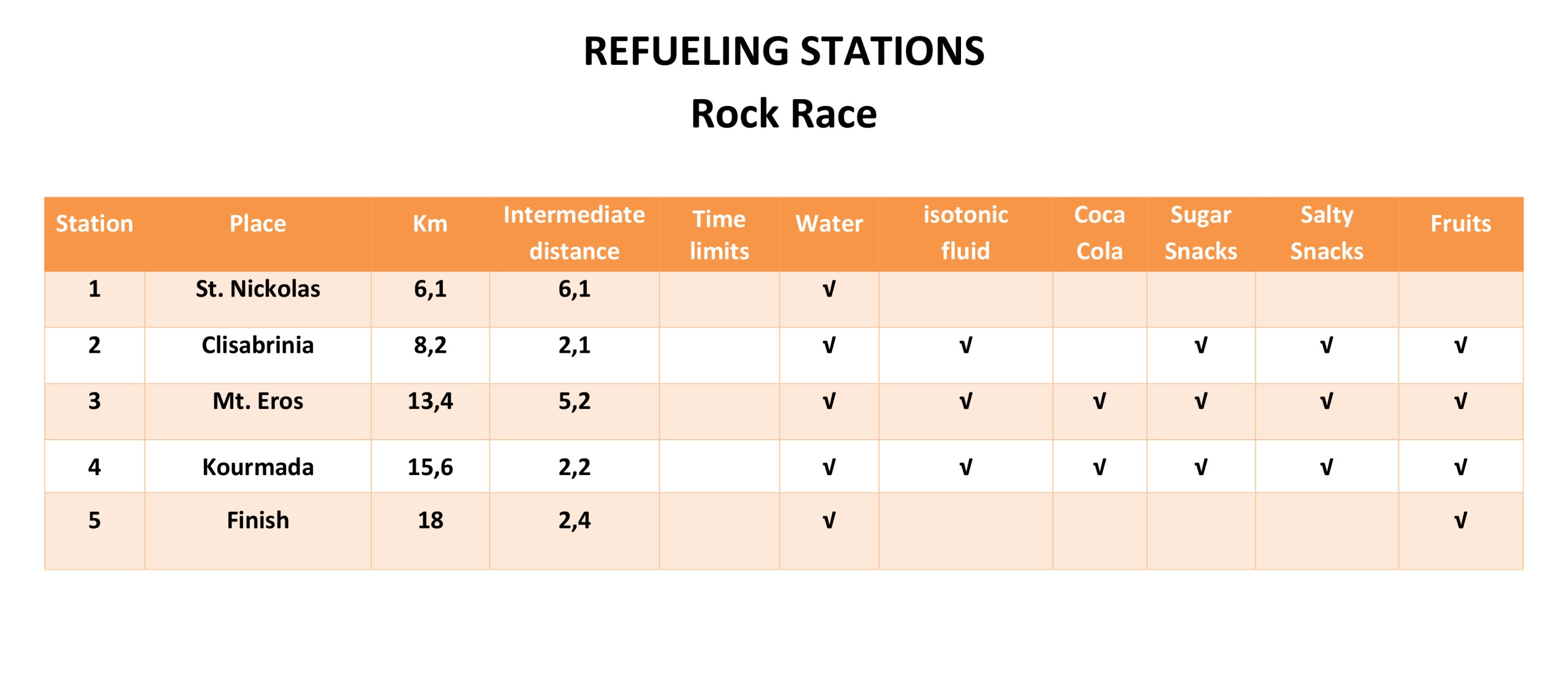
Distance: 18,0 km
The Rock Race will start at the port and the first section, as well as the last is the same as that of the Hydra’s Trail Marathon.
Altitude Profile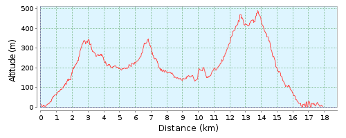
Cumulative elevation gain: 1,015 m

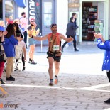
Hydra’s Trail Event 2017.
Οι αλλαγές στον φετινό αγώνα έχουν φέρει την απόλυτη ισορροπία ώστε να μην έχει παράπονο αφού έχουμε πολύ γρήγορες πίστες αλλά και πολύ τεχνικές που θέλουν μεγάλη προσοχή όταν προσπαθείς να κινηθείς γρήγορα! Δεν χρειάζεται να προσθέσουμε τίποτα στην οργάνωση, τη φιλοξενία και την ατμόσφαιρα, αφού κάθε χρονιά που περνά είναι τέλεια και δεν ξέρω τι άλλο θα μπορούσε να προσφέρει η εκδήλωση στο μέλλον.
Συγχαρητήρια σε όλους τους συντελεστές της επιτυχίας για άλλη μια φορά!

Μπράβο σας συγχαρητήρια ,σας ευχαριστώ θερμά για την απίστευτη εμπειρία που μου χαρίσατε!
Ydra’s trail race 2017. Οι αλλαγές στη φετινή διαδρομή έφεραν την απόλυτη ισορροπία ώστε να μην έχει κανένας παράπονο αφού έχουμε πλέον πολύ γρήγορα κομμάτια αλλά και πολύ τεχνικά τα οποία απαιτούν πολύ προσοχή όταν προσπαθείς να κινηθείς γρήγορα! Για την διοργάνωση, την φιλοξενία και την ατμόσφαιρα δεν έχουμε να προσθέσουμε τίποτα αφού κάθε χρόνος που περνάει το άψογο γίνεται τέλειο και δε ξέρω τι άλλο θα μπορούσε να προσφέρει η εκδήλωση στο μέλλον.
Συγχαρητήρια σε όλους τους συντελεστές της επιτυχίας για ακόμη μια φορά!